Quick Process
QuickProcess
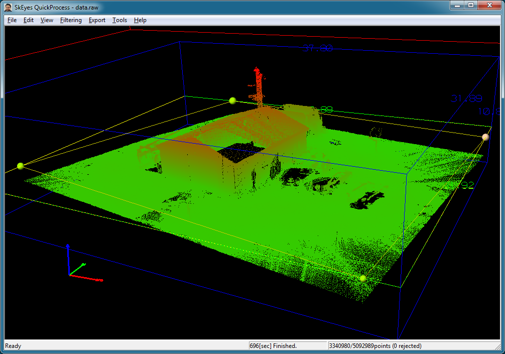
Quick Process is a 3D point cloud visualization software program.
- Integration with SkEyesBox real time and post processed data.
- Color Coded Point Cloud Display
Point Color modes
- Ambient Color
- Reflected intensity
- Height
- Range
- INS accuracy
- Top Ortho View
- Rotate around Point of view
- Point Filtering based on:
- Time window
- Scan mirror angle
- Range
- Reflection intensity
- Laser return mode
- Heading
- Horizontal position (polygon)
- Point Search
- Point Selection
- Sensor position/attitude display
- Multi-Format point cloud Import/Export
QuickProcess is included with SkEyesBox sensors.
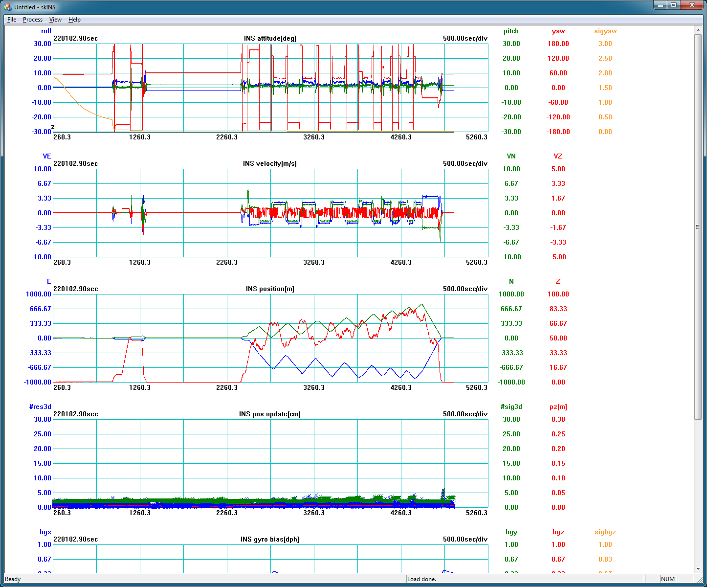
skINS
skINS is an IMU/GPS data post processing software. It integrates time-stamped, raw IMU data and GPS logs using an extended Kalman filter and outputs a best likely estimate of sensor state.
- SkEyesBox log file Import
- GPS post-processing Import
- Initial Alignment setting
- IMU parameter settings
- INS processing (extended Kalman Filter)
- Data waveform display
- KML file Export
- INS processing result Export
In combination with external GPS post-processing software (such as NovAtel's Waypoint), skINS improves the accuracy of the recorded point-cloud data collected in standalone mode. In most cases, skINS post-processing also improves the quality of real-time collected data.
The state variables and the high-precision timing information maintained by skINS can also be configured to post process data from sensors other than the sensor suite integrated by the SkEyesBox.
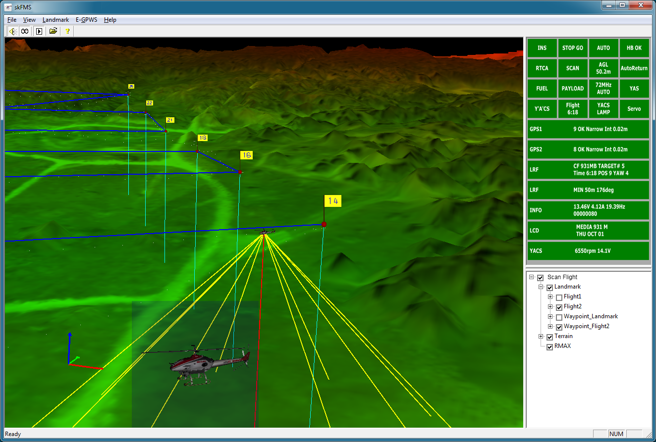
skFMS
skFMS is the user interface to the auto-pilot system of the SkEyesBox. Its main functions are:
- 3D DEM display with the helicopter outlined at the proper position and orientation.
- Helicopter and SkEyesBox state monitoring
- Ground proximity warning system (GPWS) based on the helicopter position and DEM data
- Landmark and waypoint display/edit/save/read
- Transmitting commands to the SkEyesBox
The DEM data that supports the LSF is proprietary. However, can be generated from SkEyesBox data using a conversion tool to:
- Various GSI elevation mesh data
- SRTM-1, SRTM-3, DTED
skFMS supports a number of NMEA sentences. It can serve as a GPWS for aerial unmanned systems other than the SkEyesBox.
skFMS has a flexible communication format and display and can be customized to different applications.