Click each product name for more information
Systems
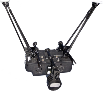
SkEyesBox
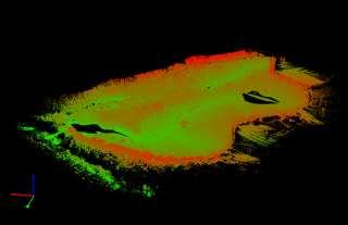
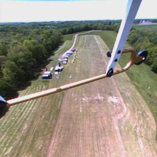
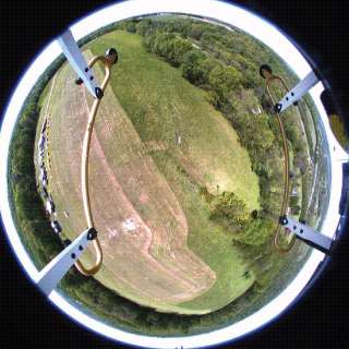
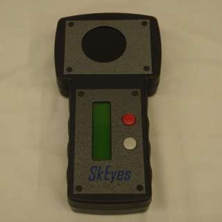
The SkEyesBox is a real time 3D aerial terrain point-cloud mapping system.
It has a simple two-button interface and collects all data on a compactFlash card.
SkEyesBox has been designed to operate on-board an unmanned helicopter. It has an optional auto-pilot system that can
also fly the helicopter during mapping flights.
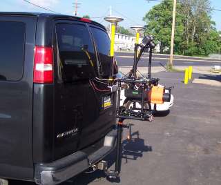
SkEyesBox itch
SkEyesBox itch is the ground vehicle model of the SkEyesBox which can be connected to an automobile using a trailer
hitch mount. It integrates an optical odometer to deal with GPS signal dropout during ground data collection.
It can be installed on a variety of cars.
SkEyesCam
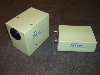
SkEyesCam
The SkEyesCam is a real time image stabilizer that integrates an IMU and a fisheye lens mounted on a camera.
The system eliminates all rotational effects and outputs a stable video image. The system is virtually maintenance-free
as there are no moving parts or gimbals.
ScribaLaser
ScribaLaser is a calibration support device and has been developed specifically to calibrate scanning laser systems.
Software
Quick Process
Quick Process is a point-cloud display and manipulation tool. It is designed for SkEyesBox point-clouds and
it exports data in different formats compatible with typical geospatial tools. It is part of the SkEyesBox system.
skINS
skINS is the post-processing software for the SkEyesBox. It combines data from external GPS post-processors to output higher-precision and more accurate point-clouds.
skFMS
skFMS is the ground interface of the SkEyesBox auto-pilot system. It incorporates a Ground Proximity Warning System (GPWS) function which warns if the helicopter is too close to the ground using registered a priori digital elevation map (DEM) data. It generates some NMEA compatible warning messages and therefore can be used by other auto-pilot systems